
Nestled in the North Atlantic, the Faroe Islands may seem like a far-flung destination, veiled in mist and wind. But don’t let the seeming remoteness fool you. The Faroe Islands are just a two-hour flight from Western Europe. The flight is an experience in itself. You’ll soar alongside craggy cliffs, before touching down onto a runway so short, the plane barely manages to decelerate in time. It’s the start of an unforgettable trip.
Despite the islands’ small physical and touristic footprint, crafting the perfect itinerary in the Faroe Islands isn’t straightforward. There are few guidebooks, few websites and even the most detailed trip recaps become outdated quickly.
In this post, we’ll outline an itinerary that you can personalize to suit your trip, and fill in with up-to-date information. Since ferry times and tour dates can change seasonally, we’ll focus on the logistics and how to divide up your time on the islands. For excursions that are time dependent, we’ll point you in the direction of up-to-date timetables.
Most itineraries for the Faroe Islands that we came across while planning had you spend the duration of your trip in Tórshavn, the capital. While Tórshavn is the islands’ best connected and provisioned city, we opted to stay across the islands using Airbnbs instead of hotels (for the most part). This choice meant we could cover more islands, and spend less time driving, than if we had based ourselves in Tórshavn. The order we lay out below goes from the west to east, then central to south. This worked for us because of our arrival departure dates, but you can mix up the order to some degree.
Itinerary Overview
- Day One: Arrival & Sørvágur
- Day Two: Mykines
- Day Three: Gásadalur Hike & Sorvagsvatn
- Day Four: Kalsoy
- Day Five: Streymoy & Eysturoy
- Day Six: Vestmanna & Kirkjubøur
- Day Seven: Tórshavn & Suðuroy
- Day Eight: Suðuroy
Day One: Arrival & Sørvágur
Depending on your flight, you’ll either have a couple of hours or up to half a day to explore once you land. When we arrived in May 2022, our Atlantic Airways flight from Copenhagen landed in the evening. We had enough time to pick up our bags, get groceries and walk to our Airbnb in Sørvágur before falling asleep.
When you get off the plane, you immediately enter a Duty Free store. If you’re interested in trying local beer or spirits, stock up now. All the locals do, partly because it’s convenient and partly because it’s cheaper than shopping at the Faroe Islands’ heavily taxed, government-operated liquor stores.
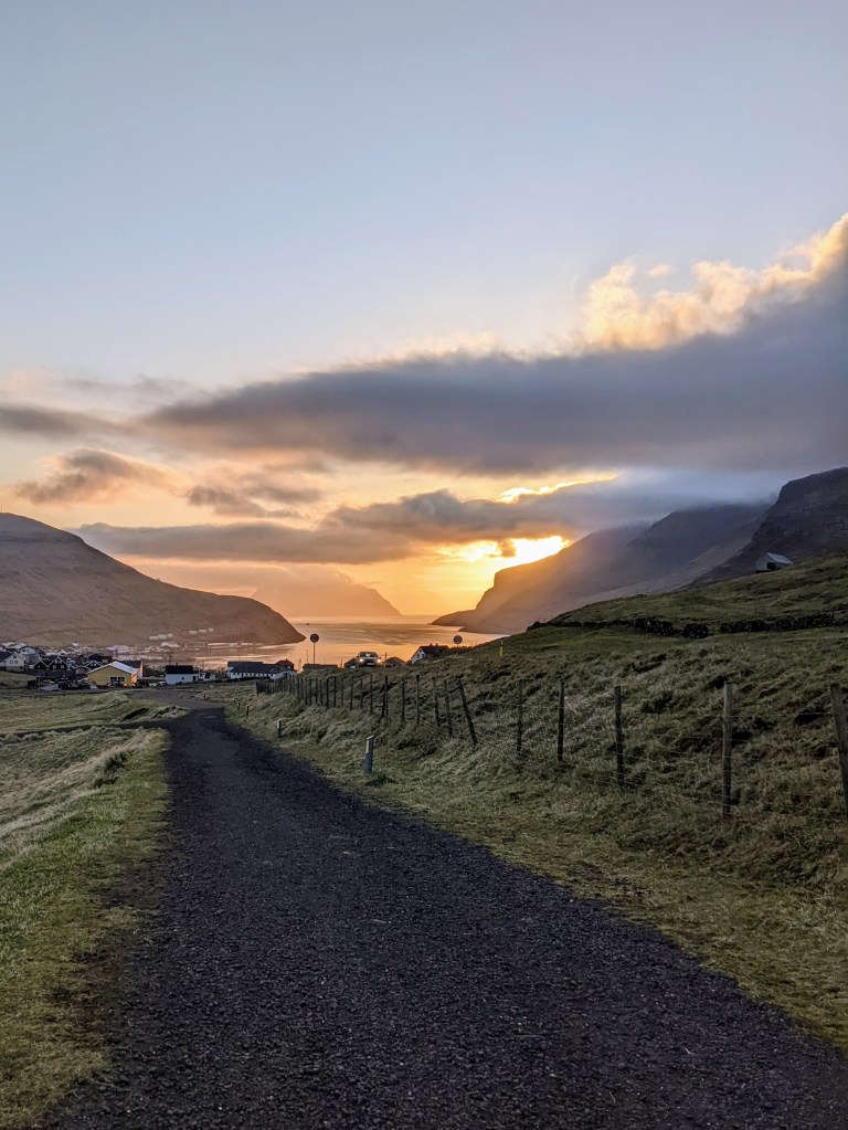
Where to Stay: We recommend spending your first night in Sørvágur, a town located to the west of the airport. We also suggest that you skip picking up a rental car on your first day. If you’re arriving late, you’ll be paying a lot of money for the minor convenience of driving to Sørvágur (a 30 minute walk from the airport). And if you follow our itinerary, you’ll be spending your first full day in the Faroes on the car-free island of Mykines. Avoiding two days of car rental will save you a good chunk of money.
We recommend booking Gróthúsið. This charming cabin is perfectly situated for the ferry to Mykines, plus it’s adorable and comfortable. There aren’t many other Airbnb and guest house options available in Sørvágur so, if you do plan to stay here, book your stay early.
Getting to Sørvágur: If you’re traveling lightly, you can walk from the airport to your lodging. It should take about half an hour. When leaving the airport, you’ll walk along the side of the road for about five minutes, before turning into the driveway for the Vagar Hotel. From there, you’ll see a paved street that passes the hotel and curves around it, which will narrow into a paved walking path and take you most of the way into town.
Bonus Tip: Once you’ve arrived in Sørvágur stop into the local grocery store to pick up food for quick breakfasts or car lunches. Restaurant opening hours can be unreliable, or a hike can take longer than you expect, rolling past lunch. This is especially true if you’re visiting in the beginning or tail end of the tourist season (early May or late September).
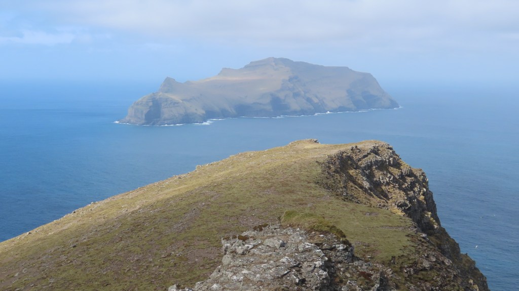
Day Two: Mykines
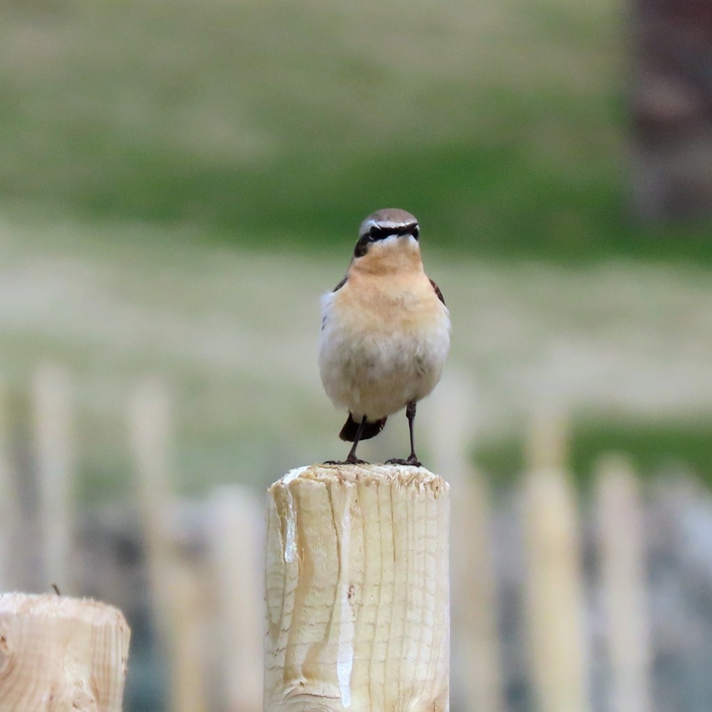
Mykines is a car-free island that’s home to countless puffins who burrow in the island’s steep grassy slopes during mating season. Unfortunately, because of its location – sitting alone in the ocean without islands to buffet the waves – you’re at the mercy of the weather when it comes to reaching the island.
Getting there: You can take either a ferry or helicopter from Sørvágur to get to Mykines. Taking the ferry will work best for most schedules as they run twice daily and can be booked further in advance. Pre-purchase your ferry tickets before you leave at Mykines.fo. The ferries leave mid-morning, around 10:45am and you should plan to arrive about fifteen minutes in advance. While tides determine the route, on your way out you can expect to see Gásadalur if you stand on the right hand side, and the Drangarnir sea stacks if you stand on the left. The ride should start smooth and get choppy as you head into the ocean. Take a wide stance and hold onto something! The total journey is about 45 minutes.
The evening return ferry should leave around 4:20pm. Since the tide has shifted during the day, the route back may not mirror the route you took to get out. If you find yourself standing on the same side of the boat, you’re likely to have a different view.
Due to the treacherous approach to the pier at Mykines and the strong ocean current, it is possible that the ferry is canceled in poor weather. If so and you are able to secure tickets for the following day, day two and day three of this itinerary can be swapped. (See the notes below for Day Three.)
Alternatively, you can look into the helicopter. Although it’s cheap (it’s subsidized by the Faroes government), fast and reliable (read: wave-free), there are only flights in the mornings and there aren’t flights every day of the week (you can check out the flight timetables on the Atlantic Airways website, linked below). You also can’t book an out-and-back flight for a single day, so if you do take the helicopter out, plan to take the ferry to return. Flights can be booked a week in advance through the Atlantic Airways website.

Logistics on Mykines: When you arrive in Mykines, you’ll need to pay a hiking fee. It cost 250 DKK per person when we visited in May 2022, and it was payable by cash or card. Even if you aren’t planning to do the hike to the puffins, you’ll be asked to pay the fee.
What to do: If you’re hiking to see puffins, head there first. The start of the trail takes you straight up the side of a mountain out of the town (also called Mykines) for a few hundred meters, before turning left and following the ridgeline of a sea-side cliff. After passing through a stone wall you will come across the Memorial Monument to sailors lost at sea. Unfortunately for us, that’s where our advice runs out because a landslide closed the trail beyond the monument when we visited! However, other guides recommend that beyond that point is a 2-3 hour round trip hike out to the lighthouse and back. This hike will take you directly through the puffin nesting grounds where you’ll be able to see these cute birds up close and personal (at least, we presume they’re cute).


If you turn right (head east) after the initial climb up the island, you can walk along the edge of a ridge, which offers gorgeous views over the town and out to sea. Be careful as you walk to avoid walking through sheep grazing land, which should be clearly marked by posts. If you follow the ridgeline for approximately 1 mile (1.6km) the trail rejoins a road which leads back into town. Time permitting, you can walk further up the road (being sure to close any sheep gates behind you) to see more amazing cliffs and untouched island. Following the road downhill will return you to the center of Mykines.
There aren’t many facilities on the island, so we’d recommend packing lunch if you are planning to hike out to the puffins. The Locals, the island’s only cafe, has limited seating and gets very busy during lunch as ferry visitors stop in for sausages or fish soup.

Day Three: Gásadalur Hike & Sorvagsvatn
Car Rental: As we mentioned above, we advise starting your car rental the day after you visit Mykines. Walk to the airport to pick up your vehicle. Depending on which rental car company you use, you pick up your vehicle remotely, simply by following email instructions to find it within the parking lot. If so, it’s still a good idea to stop inside the rental office (the small building adjacent to the Airport main entrance) and snag a free road map.
If your trip to Mykines on Day Two is canceled due to weather, there are a few ways you can swap Day Three and Day Two activities. You can call or visit the car rental office to see about extending your car rental a day earlier; you can use the SSL public buses to get around instead of your car; or you can replace Day Two with an activity around Sørvágur such as the hike to Drangarnir.
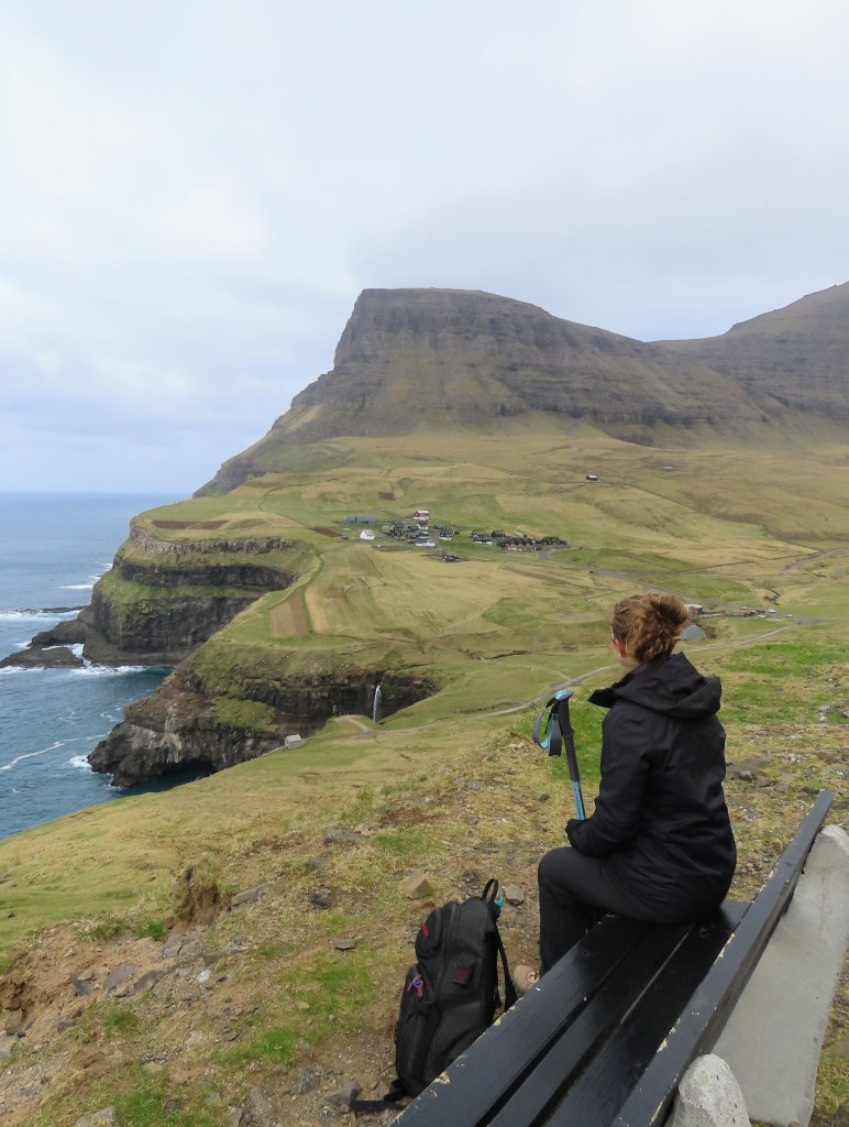
Hike to Gásadalur: Once you’ve got your car, drive to Bøur, a town on the opposite side of the water from Sørvágur. Bøur is a photo-worthy destination for its quaint grass-roofed houses, old boat houses along a black sand beach, and the small waterfall that goes through the center of the town. After Bøur, continue west down the road until you reach a turnoff to the left just before the tunnel to Gásadalur. Drive to the end of the road, where you’ll park near the trailhead for a hike that follows a mountain pass to Múlafossur (a waterfall that cascades into the ocean). This is one of our favorite hikes in the Faroe Islands, and we have an in-depth description about it in our post on the three best day hikes in the Faroe Islands.
Gásadalur: Other than the waterfall, there isn’t much to do in this town. However, do be sure to budget plenty of time for photographing the waterfall. If you want to know the exact location to get the most iconic photo of the waterfall, check out our post on where to take iconic Faroe Islands photographs.

Lunch: For lunch, we advise making some sandwiches to have in the car if you’re visiting either early or late in the season. Otherwise, head east past Sørvágur to the town of Sandavágur and eat at Fiskastykkið, which is well regarded for its open face sandwiches. Another option, located in Miðvágur, is Smiðjan, which serves mostly burgers and fries.
Sørvágsvatn: After lunch, drive over to Sørvágsvatn, the Faroe Islands’ famous lake on a cliff. While some guidebooks and blogs say there are two hiking routes around the lake, these days there’s only one official trail, and it costs to walk along it. Drive to the visitor’s center outside of Miðvágur. The visitors center will be marked on the tourist map, which is posted in town near the church. At the visitor’s center, you’ll pay your fee, be offered a hot drink, and then head off to the trail. It’s more akin to an easy walk. This might be one of the most expensive hikes, but it’s worth it.
Where to Stay: To be well-positioned to explore the northern islands on the following day, we recommend staying in Klaksvík. It’s the Faroe Islands’ second largest town, but it’s still relatively small and walkable. Since there aren’t many hotels, it’s best to stay at an Airbnb. We stayed at this spacious apartment in the center of the city, which we thoroughly enjoyed.
Dinner: Despite being the second-largest town, there aren’t many restaurant options in Klaksvík. For a sit-down meal, head to Angus Steak House. It’s a chain, but one of the nicer options available. If you’re running low on groceries, the city has a large Bonus supermarket to stock up on groceries for breakfast or road lunches – you’ll want one for the next day’s trip to Kalsoy.

Day Four: Kalsoy
Ferry to Kalsoy: Kalsoy is just 3 miles from Klaksvík, but you’ll need to hop on one of the none-too-frequent ferries to reach the island. There are two morning options, one that leaves just before 7am or one departing around 9am. The ferry only carries a dozen cars, so you’ll want to arrive early to guarantee your spot. We opted for the 7am ferry, having heard about people waiting in hour-long lines to board, and ending up getting turned away for both the 7am and 9am departures. In retrospect, when we visited early in the season during 2022, we would have been fine with the later one. Consider the time of year you’re visiting when choosing what time you want to depart.
In terms of payment, you’ll only pay on the trip to Kalsoy. Retain your ticket for the return journey for proof of payment. The ferry costs 40 DKK per person and 160 DKK per car.
Trøllanes & the Lighthouse Hike: Once you arrive on Kalsoy, head straight for Trøllanes on the northernmost end. Here you’ll find Kallur Lighthouse, one of the most photographed spots in the Faroe Islands. The hike is a relatively straightforward walk from the center of town, but you should still wear your hiking boots and outdoor gear as the ground can get muddy and the weather can turn blustery (if it isn’t already when you start out). For an in-depth guide on this hike, consult our detailed post on the best day hikes in the Faroe Islands.
If you’re hankering for a more strenuous hike once you’ve seen the lighthouse, our guide also has details on a hike that will take you to the top of the mountain bowl surrounding Trøllanes.
Exploring Kalsoy: Once you’re done hiking in Trøllanes, then take the rest of the morning and early afternoon to explore Kalsoy. There’s not a lot to see in any one town but each has some interesting elements. To get the most out of your time, we recommend slowly driving back along the island’s only road and looking for the boards posted by Visit Kalsoy (the island’s tourism board). These boards share a bit of information about local history, hikes and attractions.


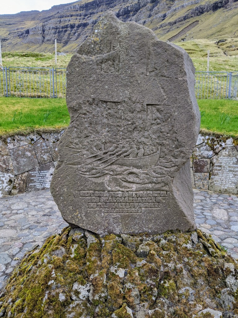


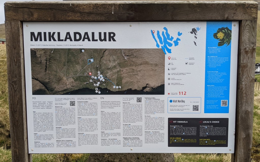


In Mikladalur, be sure to walk down to the water and see the statue of the Seal Woman. It’s in a gorgeous location, and the accompanying myth will leave you scratching your head.
Be sure to arrive back in Syðradalur with enough time to line up and board the ferry. You can check the most recent times on this website, but expect to return in the early afternoon.
Kunoy: After the ferry ride, you should have plenty of time left in the day to do more exploring in the northern islands. Start by driving out to Kunoy Park. While the Faroe Islands isn’t bereft of trees, this is one of the few proper parks you’ll encounter outside of Tórshavn. It’s a unique spot to wander around. Test your upper body strength by climbing to the top of the rock in the center of the park!


Viðoy: Follow the road across Borðoy to Viðoy, then head to Viðareiði in the north. This gorgeous town is bordered by water on two sides and mountains on the other two. If you have the time and the weather is cooperative, take time to hike up Villingadalsfjall on the town’s northern edge for views out over the North Atlantic and across Viðareiði to Malínsfjall. You can find details in the Faroe Islands’ official hiking guide.
On your return to Klaksvík, don’t follow the route you came. Instead, depart Viðareiði following the road that heads toward the northeast. This is one of the Faroe Islands’ many Buttercup routes, which denote a particularly scenic area.
Extend Your Stay: If you decided to extend your stay in the northern islands, there are several additional worth stops:
- Drive out to the abandoned town of Múli. The route passes several beautiful waterfalls and, on arrival, there is a short hike to a nearby gorge where locals used to climb down the cliffs to gather bird eggs.
- Take the ferry to Svinoy and/or Fugloy. These two islands offer hiking and completely remote isolation. Sweeping cliffs, large puffin populations, and stunning sunsets are their hallmarks.
- In Viðareiði, extend your hike up Villingadalsfjall all the way to Cape Enniberg, the highest promontory on earth (at ~2700 feet, 750m). This hike takes 5-6 hours round trip and is strenuous.
Dinner: Return to Klaksvík for dinner. Since you’ve been out all day, picking up a pizza from Frank’s and heading back to your accommodation is likely to be an attractive option!

Day Five: Streymoy & Eysturoy
Klakkur Trailhead: Before you depart Klaksvík, drive out of town and to the Klakkur Trailhead for a fantastic view over the city. The vantage point allows you to appreciate the city’s unique layout; it faces the water on two sides. While there is a hike that you can do to the top of Klakkur (the nearby mountain), we recommend saving time and driving back into the city for breakfast.
Breakfast: There aren’t many options outside of Tórshavn for a sit-down breakfast outside of hotels, which is part of what makes Frida Kaffihus, in one of Klaksvík’s harbors, so delightful. Get a coffee, a pastry and relax before hitting the road.
Optional Stop – Toftir and Nes: When we originally sketched out our itinerary, we didn’t plan to stop in Toftir and Nes, but we added it in when we learned that the town had a popular local-run wool boutique, Navia. The boutique has some very stylish woolen items, but they’re definitely not cheap! Still, it’s a good spot if you’re looking for something unique to take home. Once you’re in Nes, be sure to head down to the World War Two fortress, where the British watched for approaching German boats. Time permitting, drive the Buttercup route that takes you south out of Nes and circles back to Runavik.


Gjógv: Back up on the northern tip of Eysturoy, head to Gjógv. The town’s name literally means gorge, and that, fittingly, is its most notable feature. You can walk down to the water’s edge in the gorge, then climb up a nearby hill for another vantage point (this is also the location of one of the Faroe Islands’ most iconic photos).
Lunch: If you want to stop for a sit down lunch, Gjogv is a good place to do so. During the high season there’s a cafe at the entrance to the gorge for light bites and sandwiches. Otherwise, you can get a slightly pricier option at the Gjogv Guesthouse. That being said, sitting down can take a bit of time. If you want to pack more into your day (and have provisions for a road lunch), it’s a good time to crack open the trunk and prepare a roadside sandwich.
Slættaratindur: Whether or not you have the time, desire, or weather to hike up the Faroe Islands highest mountain, it’s worth stopping by to say you’ve seen it. When we visited, the weather didn’t cooperate – fog lowered visibility to just 20 feet (6 meters). If you’re interested in hiking to the top of the mountain, see the details in the official Faroe Islands hiking guide.
Optional Stop – Tjørnuvík: Across the water, on the northern coast of Streymoy, lies Tjørnuvík. This town is famous for its black sand beach and for its annual and controversial whale hunts. While it’s not going to be a long layover, it’s well worth a stop to see this unique long square bay. Take a few photos, appreciate the landscape, read the tourism board and then make haste to your next destination.

Saksun: The drive out to Saksun from Hvalvík is another Buttercup Route. It was our hands-down favorite drive. Tall mountains (well, tall for the Faroe Islands) rise up on either side of the twisty one-lane road. There’s a stream that runs alongside the road and notably changes direction about midway through the drive.
Once you arrive in Saksun, you’ll find a couple large parking lots. When we visited in early May 2022, they were completely empty. If you find it’s busier when you arrive, nab the first spot you come to.
The town is gorgeous to walk around – surrounded by tall mountains with several cascading waterfalls and a view straight out to sea. It’s painfully easy to understand why this location has become overrun with tourists. Even if you’re alone during your visit, you’ll sense the presence of previous tourists through the copious signs warning you not to fly drones, trespass on private property, or be noisy.
We recommend walking into the churchyard to admire the Saksun tidal pool from above, and then heading down toward the water. There is a paid hike (automatic gate with a credit card swipe) which takes you down to the tidal pool and its black sand beaches. If you have the time, we’d advise doing the hike just to spend more time in this gorgeous setting. To spend additional time in Saksun, pop into the local museum or go on a short hike to the waterfalls, which leaves from just above the museum.
Where to Stay: For this evening, we recommend staying in Tórshavn, the capital. There are plenty of accommodation options, whether you want a fancy hotel, casual hotel or another Airbnb. We opted to stay in the fancy Hotel Føroyar, which is a bit out of town but a luxurious treat. A great alternative is Havgrím Seaside Hotel 1948. This cute B&B in a restored house with ocean views is located just 1000 feet (300 meters) from the historic Skansin fort and the rest of Tórshavn’s downtown area
Dinner: Tórshavn is the only place in the Faroe Islands where you’ll have plenty of options for food. Take advantage! On our first night, we had reservations at Katrina Christiansen, a cozy restaurant serving Faroese-inspired tapas in the former home of local writer William Heinesen.
Day Six: Vestmanna & Kirkjubøur
Breakfast: If you’re staying in a hotel, a breakfast buffet should be included. If you’re staying at an Airbnb, we’d advise making breakfast yourself to give plenty of time to drive to your first destination of the day.

Vestmanna Bird Cliffs: From Tórshavn, drive forty minutes to Vestmanna for a ferry ride to the Vestmanna Bird Cliffs. Visitors in the high season (July/August) will witness countless birds circling overhead and perching in teetering cliffs. In the off-season, there are still plenty of birds but the focus is more on seeing the towering cliffs and sea stacks from below. Take a small boat tour to be able to get close up to these impressive cliffs. When we went it was foggy and misty, but our photos from that day feature some of the most beguiling landscapes. Be sure to dress warmly and in waterproof/resistant clothing – you’ll want to spend most of your time outside, on deck. Expect the tour to take between two and two-and-half hours.
Lunch: For lunch, head back into Tórshavn. To make it easy, stay on the ring road and stop by the lovely café at Nordic House. The café has a good range of sandwiches, soups and pastries. There’s also free Wi-Fi, newspapers and plenty of seating and parking.
Kirkjubøur: There are two ways to get to Kirkjubøur from Tórshavn; you can hike or drive. The out-and-back hike will take you about an hour and a half one way, but you can see the highlights by walking about halfway, then returning to your car to drive to Kirkjubøur.
The trailhead leaves from the outskirts of Tórshavn, between Landavegur and Velbastaðvegur – this is just past a bus stop and near a barn. A small paved area to your right side (look for the shipping container) is the best place to park. This is an easy hike with minimal hills involved. If you hike until Reynsmúlalág – a lectern made from rocks that was used as a place for public meetings from the nineteenth century through to the 1960s – you’ll be walking about thirty to forty minutes. It was incredibly foggy when we hiked, so we couldn’t tell you much about the landscape, but it was a fun and enjoyable way to spend a portion of the afternoon.


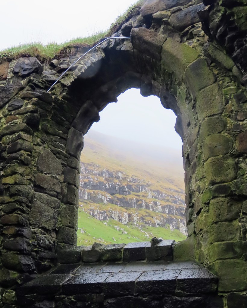
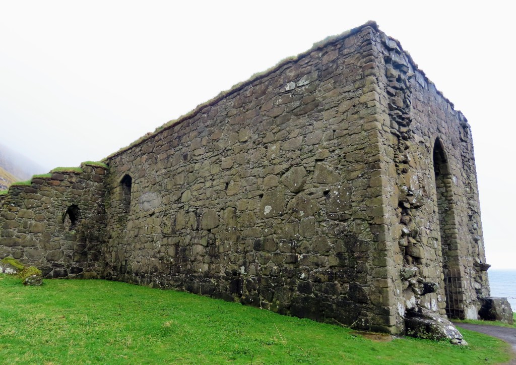
But Kirkjubøur is more engaging than just the hike to reach it. The main attraction is Kirkjubømúrurin, the ruins of a medieval cathedral and the largest such ruins in the Faroe Islands. It’s an impressively sized building, which you can walk around and peer at the mountains through the gothic windows. Afterwards, spend time walking around the town, which has some absolutely picturesque buildings looking out toward the ocean.
Tinganes: Once back in Tórshavn, head downtown to the historic area of Tinganes. It’s home to the oldest continuously operating parliament building in the world, but the small scale of its buildings and circuitous streets is what will charm you. It’s just a small area, but it’s easy to spend a good portion of time here.
Dinner: Once again, take your pick of Tórshavn’s restaurants. For a remote location, the Faroe Islands is host to some of the top restaurants in the world including the two-Michelin starred KOKS (temporarily moved to Greenland the 2022 and 2023 seasons), ROKS, and Ræst.

Day Seven: Tórshavn & Suðuroy
Breakfast: If you’ve tired of your hotel breakfast, head to central Tórshavn to try one of the city’s coffee shops. Try Paname Cafe or Kaffihusid, both of which are near Tórshavn’s old town and open around 9am during the high season.
Tórshavn: Spend your morning exploring downtown Tórshavn. The city is extremely walkable. If you’ve already spent a good deal of time exploring the old city, make your way to Skansin. This fort and lighthouse overlooks the harbor. On a clear day, you’ll have a great view of the island of Nolsoy across the harbor. You’re also near one of our favorite photo spots for the old parliament – check out where it is in our photo guide to the Faroe Islands.
Another lovely attraction, albeit outside of the downtown area, is Viðarlundin park. It’s an idyllic tree-lined walk alongside a small stream, which passes between quiet residential neighborhoods.
Tórshavn is also an excellent place to pick up some souvenirs. On Niels Finsens Gøta, you’ll find Føroya Heimavirkisfelag, a community-operated knitwear store that sells items handmade by locals. A bit further down the street, the local tourism office, Visit Tórshavn, has a lovely gift shop with a variety of local-made items. You can also stop by to pick up free maps and guides to Tórshavn and the surrounding islands.
Ferry to Suðuroy: The ferry to Suðuroy leaves around lunchtime from the harbor. Depending on the day you travel, the ferry may be more or less crowded. We took the ferry on a Friday afternoon, which is one of the most popular trips as many people are traveling home to Suðuroy after spending the week working in Tórshavn. The ferry is very large, but in peak season it’s best to line up early so that you are sure to get a good seat (and a spot for your car if you are driving). Boarding happens about half an hour earlier than the scheduled departure time. Check here for the most up-to-date timetables. If you miss your ferry, or it’s too full for you to get onboard, they run about every 4 hours.
If you are taking a car on the ferry and traveling with more than one person, then the passengers will have to get out of the car and board separately. Based on our experience, this rule is only enforced in Tórshavn. Still, it’s a good idea for one of your travel companions to snag a seat with a window view while the other parks the car. You don’t need tickets to board the ferry and you won’t pay on the Tórshavn-Suðuroy route. Instead, you’ll pay for your tickets on your return journey.
If your ferry leaves around lunchtime, the cafeteria on board will be the most popular destination. The food lines won’t open until the ship departs. There are two separate lines for food, one for the traditional meal (pork, cabbage and potatoes when we took the ferry) and one for fast food (burgers, sausages and french fries). The fast food line tends to be the longest, so if you’re planning to get the traditional meal you can expect to walk straight up to the buffet.
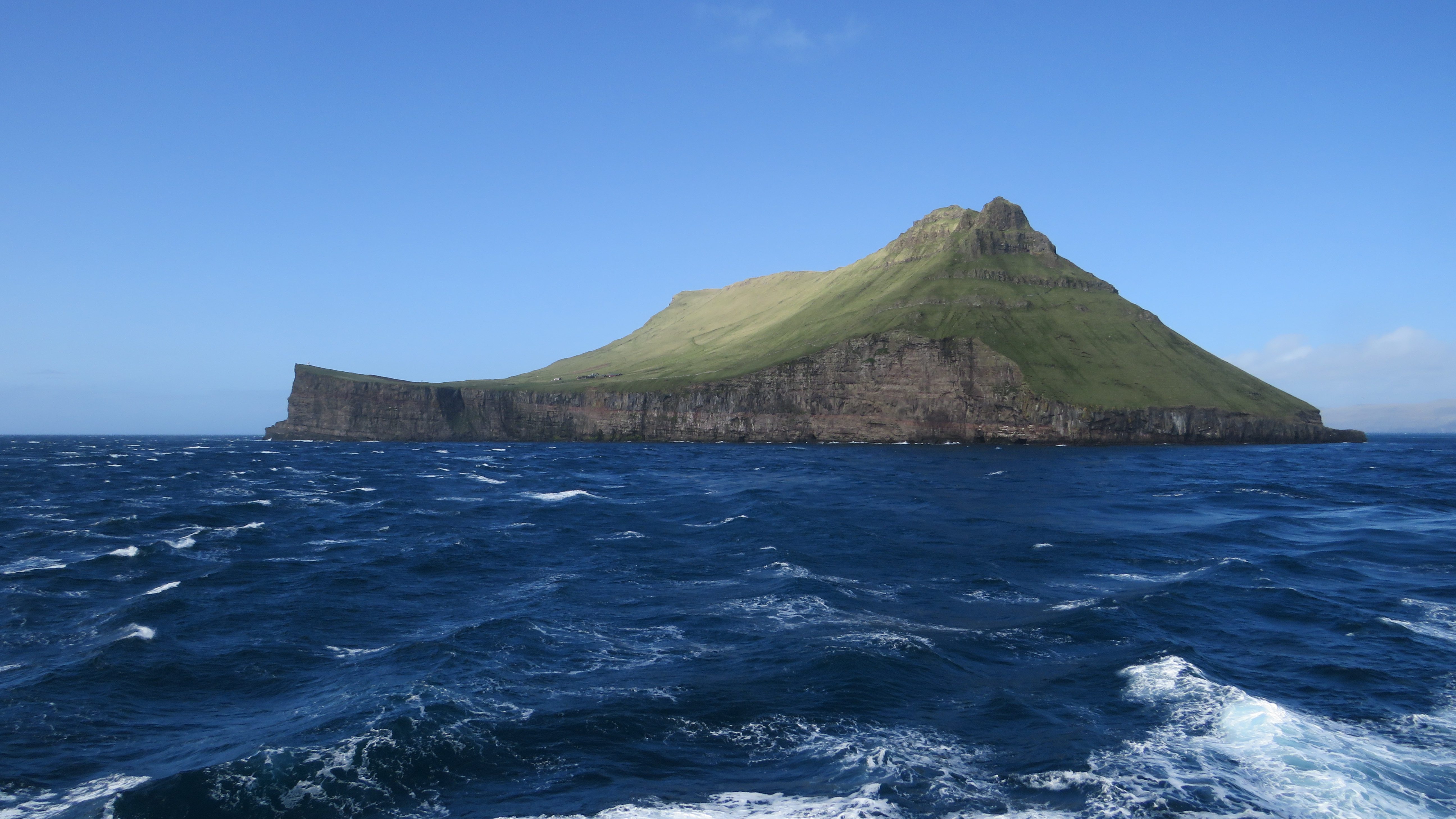
After lunch, head to the open decks at the back of the ship. A portion of these decks are covered, so you can stand outside even if it’s drizzling. You’ll want to stand on the starboard side of the ship for views of Sandoy, Stóra Dímun and Lítla Dímun. Look for the farm on Stóra Dímun, and if you have binoculars (or a really good camera zoom) you may be able to spot some sheep on Lítla Dimun!
As you approach Tvøroyri, there will be an announcement for drivers to return to their cars. Passengers disembark separately, and you can meet up outside the main ferry terminal.

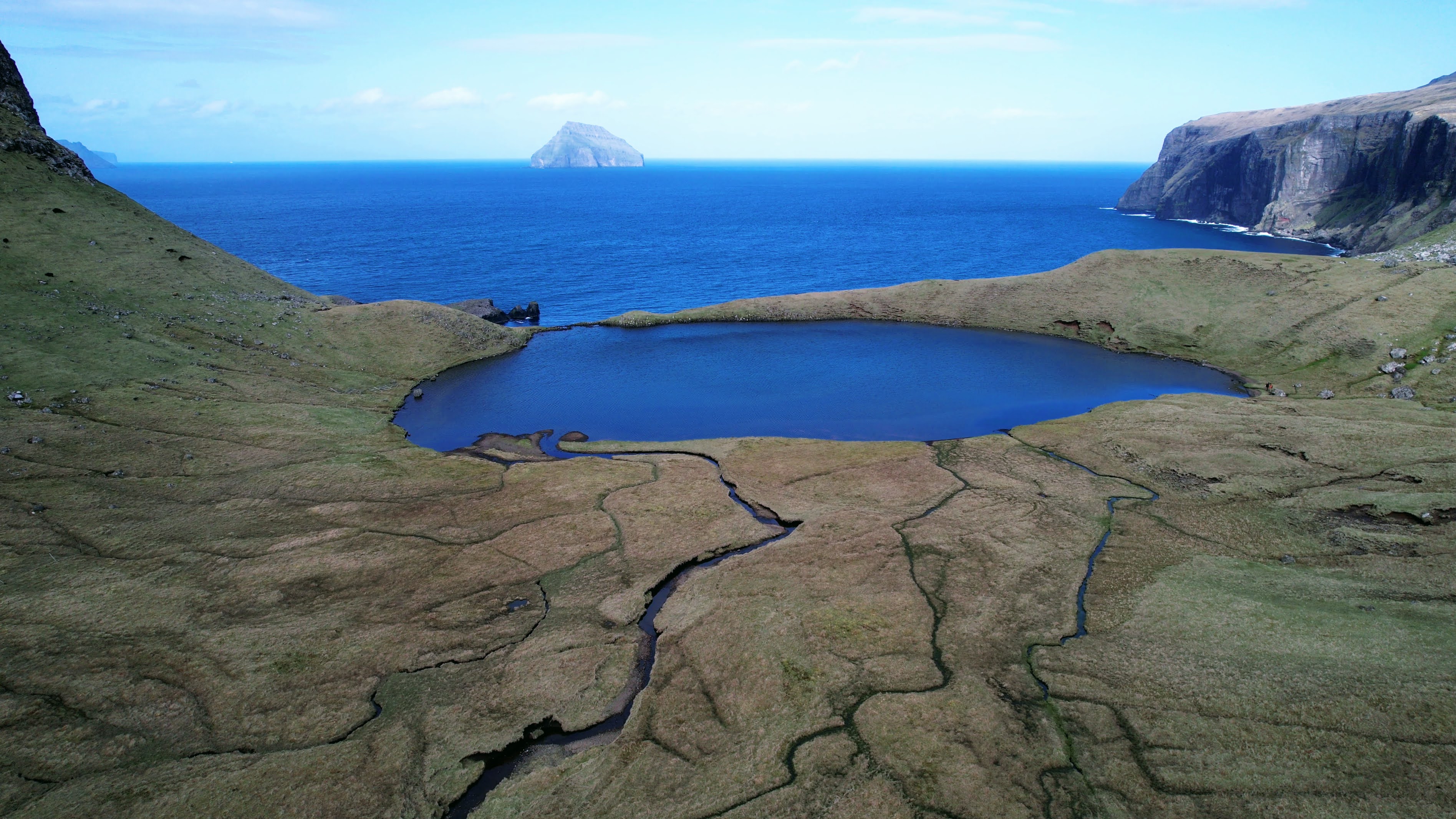
Hvannhagi: If the weather is cooperating with you on your arrival in Suðuroy, then head to Tvøroyri upon leaving the ship. From here, you can hike to Hvannhagi, a gorgeous lake within a mountain bowl perched above an ocean view that frames Lítla Dímun. The lake is tucked behind some hills north of the town. We have all the details for this hike in our guide to the best day hikes on the Faroe Islands. Expect the hike to take about two to three hours if the weather is good and you stop for photos.
Where to Stay: Suðuroy is a bit off the tourist track, so there aren’t many hotels on the island. We stayed at a secluded cabin Alex found on Airbnb, which was a highlight of our time on the island. If it’s available during your trip, we highly recommend staying there for a unique experience. Otherwise, checkout Bed & Breakfast Suðuroy as a good alternative.
The drive to the Airbnb is along another Buttercup route – you’ll definitely want to stop for photos along the way!
Dinner: Before leaving Tvøroyri, stop at the Bonus supermarket in the center of town by the water. We picked up some frozen ready meals for dinner, plus food for breakfast and lunch the following day. There’s not much tourism infrastructure on the island, so it’s best to avoid relying on changeable restaurant opening hours.
Day Eight: Suðuroy
Breakfast: Plan on having breakfast at your accommodation before heading out for the day.
Akraberg Lighthouse: If you’re staying at the secluded cabin we recommend, head south toward Sumba to see the Akraberg Lighthouse. This lighthouse marks the southernmost point in the Faroe Islands. While the lighthouse is on private land, when we were there we spoke to the owner who was happy to let us walk out to it. It’s a bit of a treacherous walk, so take care if it’s wet or windy.
Fámjin: It’s a bit of a detour to reach Fámjin, but we think it’s worth it for the unique attraction that lies at the end of the road. The town’s church houses the first version of the Faroese flag, which was made by a local group of students campaigning for independence.
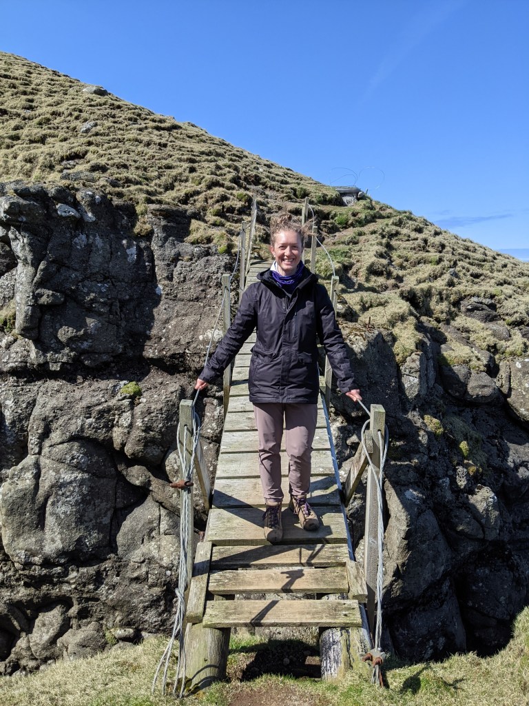

Sandvík: From the southernmost point of the island, drive up to the northernmost point. Even with a stop in Famjin, the trip shouldn’t take much longer than an hour. From Sandvík, head to the eastern outskirts of town to hike to Rituskor. This overlook gives you a view of Ásmundarstakkur, the tallest freestanding sea stack in the Faroe Islands. Along the route you will have an option to cross a precarious bridge onto Rituskor for remarkable views of the ocean and bird life.
Afterwards, we recommend stopping in on the outskirts of Sandvík for lunch. A little parking area offers a peaceful spot near the water.
Froðba: Head back down to Tvøroyri but follow the road out of town to the east to reach Froðba. As soon as you leave Tvøroyri, look for a series of rectangular basalt columns along the left hand side of the road. This is the same type of formation that made the Giant’s Causeway in Ireland.
If you have time before the afternoon ferry back to Tórshavn, you can take a walk up toward Froðbiarnakkur. The hike follows a former road and isn’t very interesting. But it’s the views toward the ocean and the World War Two-era lodgings for British soldiers that make the hike interesting. We recommend hiking to the old lodgings, enjoying the landscape and then returning to your car.
Ferry to Tórshavn: When we traveled to Tórshavn from Tvøroyri, the crowds were quite light. We lined up about half an hour before departure.
Once you board and park your car, head to the news kiosk to pay for your ticket. There will be announcements on board to remind you and to tell you where to go. Afterwards, find a seat and relax on the ride back. The kiosk will not be open for the entire journey, so it’s best to pay straight away. Expect to pay about 80 DKK per person, plus 225 DKK for your car.
Dinner: Plan to have dinner as soon as you arrive back in Tórshavn. We tried Etika, a sushi restaurant near the harbor, which was very tasty and seemed popular with locals.
Where to Stay: Depending on when your flight out is the following day, stay either in Tórshavn or at Hotel Vágar, near the airport. Hotel Vágar is a self-service hotel and is nothing special apart from its proximity to the airport.
